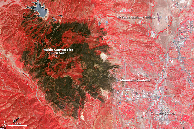
NASA Satellite Picks Up Stunning Image of Colorado Wildfire Damage
On July 4th, the Advanced Spaceborne Thermal Emission and Reflection Radiometer (ASTER) on NASA’s Terra satellite captured this image of the damage done by the Colorado wildfires. In brown, the false-color image shows how far the fires spread as responders struggled with limited resources and funding. The Waldo Canyon Fire, caused and exacerbated by record heat and drought, burned 18,247 acres of land, combusted 346 homes, and killed two people.


You can return to the main Market News page, or press the Back button on your browser.

