
Why East Antarctica is a 'sleeping giant' of sea level rise
Scientists once thought the East Antarctic ice sheet, which contains enough water to raise sea levels 52m (170ft), was stable. But now its ice shelves are beginning to melt.
Jan Lieser had just started going through the dozens of satellite images he looks at every day when he realised something was missing. As a glaciologist at the University of Tasmania’s Institute for Marine and Antarctic Studies, he knew the shape of every ice shelf sticking out from the coast of East Antarctica. And on 17 March 2022, there was a gap where most of the Conger glacier’s ice shelf had broken off into an iceberg the size of Vienna and drifted away.
Lieser was stunned. He had been keeping an eye on Conger since the last few pieces of the neighbouring Glenzer ice shelf had broken up 10 days before, but he had not expected to see it disintegrate so quickly. “All of a sudden the rest of the land-fast ice collapsed, and the ice shelf moved northward and turned 90 degrees sideways. Two features we had been monitoring for years weren’t there anymore,” he says. “In my 15 years of looking at it, I have not expected to see that in East Antarctica.”
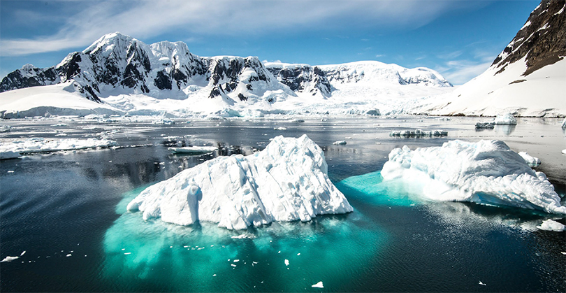
Glaciers flow toward the ocean, and an ice shelf is the part that floats on the water, rubbing up against islands, underwater ridges or other glaciers. Ice shelves are often called Antarctica’s “safety band”. When they break up, the glaciers behind them can start flowing faster into the sea, contributing to sea level rise. The Conger glacier is relatively small and slow, but the swift demise of its safety band nonetheless had scientists worried. This was the first ice shelf on record to collapse in East Antarctica, the vast frozen dome separated from the more travelled West Antarctica by the tortuous sandstone ridges of the Transantarctic Mountains. While the melting West Antarctic ice sheet may have already reached a tipping point, scientists had long thought that its eastern counterpart, the coldest place on Earth, was resistant to global warming. In 2012 the East Antarctic ice sheet had even been found to be gaining mass overall.
But new research is revealing chinks in East Antarctica’s icy armour. Some glaciers in what one explorer called the “home of the blizzard” are melting and might be at risk of sudden collapse. Even small changes to the East Antarctic ice sheet, which contains four-fifths of the world’s ice, could have a colossal impact. It holds an estimated 52m (170ft) of potential sea level rise, as compared with 3-4m (10-13ft) in the West Antarctic sheet. Experts fear it could start raising sea levels already this century. “It’s a big bear you don’t want to poke,” says University of Minnesota glaciologist Peter Neff, who’s leading a project to drill an ice core that’s 1.5 million years old in East Antarctica. “When you see things that give you a sense that you might be underestimating what’s going on in East Antarctica, that gives you pause and certainly motivates further research.”
Antarctic heat wave
Usually, glaciers move at a glacial pace. The speedy collapse of the Conger’s ice shelf came after some of the most dramatically warm weather ever observed in Antarctica. For the first time since satellite monitoring began in 1979, the sea ice extent around Antarctica dropped below 2 million sq km (770,000 sq miles). Less sea ice means more waves battering the ice shelves in front of the glaciers. Massive fields of sea ice off of Adelie Land, Wilkes Land and Princess Elizabeth Land in East Antarctica completely disappeared.
The lack of ice startled scientists. Unlike in the Arctic, Antarctic sea ice had been slightly increasing over the period that satellites had been able to monitor it, and some suggested that circumpolar winds and ocean currents were isolating it from global warming. A study later blamed the 2022 sea ice low on ocean heating, as well as intense winds driven by La Niña and other weather patterns.
Then in March, when the brief austral summer had already waned, a heat wave brought mind-boggling temperatures to East Antarctica. An extreme atmospheric river of water vapour stabbed into the heart of the continent, followed by a high-pressure “heat dome” that kept this warmth from dispersing. In the middle of the ice sheet, Russia’s Vostok station, which once recorded the lowest temperature ever seen on Earth (-89.2C/-128.6F) in midwinter, enjoyed a comparatively balmy autumnal -17.7C (-0.1F).
At Dome C, the easterly apex of the sloping ice sheet, European researchers from the Concordia base staged a photo in swimwear under blow-up palm trees. The -10.1C (13.8F) temperature on March 18 was 38.5C (69.3F) higher than average, the biggest rise above normal observed by any weather station in history. Antarctica experts described the heat wave as “impossible”, even “inconceivable”.
While the heat may have contributed to the Conger ice shelf’s collapse, Lieser thinks significant swell from two nearby storms probably struck the fatal blow. But concern that Antarctica may be entering an uncertain new era has only grown. This year, sea ice around the continent fell to a new record low. On 13 February 2023, the sea ice shrank to just 1.91 million square km (737,000 sq miles). “Will it turn around? Have we crossed a tipping point? That’s the million-dollar question,” Lieser says.
‘Accursed place’
For centuries, the remoteness and cold of East Antarctica preserved its solitude. Although this was the first part of the continent to be discovered, by a Russian expedition in 1820, attempts to reach the South Pole used the far shorter route through West Antarctica.
In 1911-14, the Australasian Antarctic expedition finally explored 4,000km (2,480 miles) of the East Antarctic mainland, giving us not only scientific findings like Antarctica’s first meteorite but also one of the greatest polar survival stories. A member of one of the exploratory parties disappeared into a deep crevasse with most of their food and equipment, leaving his two companions to eat their sled dogs one by one as they tried to reach the expedition’s hut 500km (310 miles) away. Only one of the two, Douglas Mawson, survived. “We had discovered an accursed country,” wrote Mawson. “We had found the home of the blizzard.”
During the Cold War research bases like the Amundsen-Scott South Pole station and a short-lived Soviet station at the pole of inaccessibility were established. But otherwise East Antarctica has received less scrutiny than West Antarctica because it didn’t seem to be changing as much and was even more challenging for research. At the start of the 21st Century, much of the bedrock under the ice sheet still hadn’t even been surveyed.
To fill in that last blank spot on the map of the Earth’s land surface, glaciologist Martin Siegert and colleagues organised the Icecap and Icecap 2 projects starting in 2008 to fly over more than 150,000 sq km (58,000 square miles) of East Antarctic territory in modified WWII-era DC-3 ski planes. As computer models became more precise, scientists needed to know the contours of the bedrock to predict the flow of glaciers – and thus sea level rise – in different warming scenarios.
“If you’re going to apply a really sophisticated model over a topography that’s just flat because you’ve got no data, it’s pointless,” Siegert says. Antarctica’s ice is melting not from above but from below. As relatively warm ocean water eats away at the sloping underside of an ice shelf, the grounding line where it meets the seafloor recedes. That process should stop at the coast – unless the bottom of the glacier there is below sea level. The Icecap planes’ ice-penetrating radars helped discover a “weak underbelly” below East Antarctica’s largest glacier Totten, which holds about as much potential sea level rise as all of West Antarctica.
The Aurora Basin, a giant bowl of ice feeding the Totten glacier, was much deeper and wider than expected, and it was connected to the coast via channels lying below sea level. If Totten’s grounding line were to retreat through these channels, ocean water could eventually start flowing down into the basin and kickstart runaway melting. That’s happened several times there in the distant past, research has suggested. Sure enough, Totten’s grounding line is now retreating as its ice shelf melts.
In summer 2015, an opening in the sea ice allowed scientists on the Australian icebreaker Aurora Australis to reach the towering white face of the Totten ice shelf for the first time. Lowering an assembly of sampling bottles into the ocean there, they found 220,000 cubic metres (7.8 million cubic ft) per second of relatively warm water were flowing toward the base of the ice shelf through a kilometre-deep trough, melting up to 80 billion tonnes of ice each year. Increasing precipitation inland, where snow turns to ice could compensate for that loss – but not forever. If another 4.2% of the Totten ice shelf melts, it could collapse and allow the glacier behind it to surge into the ocean, one study found. “We don’t discount at all that East Antarctica can start realising mass into the ocean within this century,” Siegert says.
Big surprise
To measure how much warm water was getting to Totten year-round, Australian scientists began parking 360 yellow, torpedo-shaped robots called Argo floats in the ocean there to overwinter under the sea ice. But when the sea ice broke up in 2020 and the floats surfaced to start transmitting temperature and salinity data, it turned out one had drifted 700km (430 miles) along the coast to the Denman ice tongue. This is where the Denman glacier crashes through the Shackleton ice shelf to reach the sea in what one member of the Australasian Antarctic Expedition described as “cascades of shattered ice, so broken that it stood out [as] a great white scar on the ice cap”.
The float’s location was a stroke of luck, as scientists had almost no information about the ocean near Denman, besides a few readings from a sensor strapped to a wide-ranging elephant seal in 2011.”It was a big surprise,” says Laura Herraiz Borreguero, an oceanographer at the Commonwealth Scientific and Industrial Research Organisation in Tasmania. “I got very excited. I went and downloaded all the data from the float.”
Published late last year, the data revealed even more concerning heat transport here than at Totten. Over four months, the float found that an immense amount of warm water was flowing into a deep trough beneath the Denman ice tongue, enough to melt 70.8 billion tonnes of ice per year. This offered a possible explanation why the grounding line where the ice meets the seafloor had receded more than 5km (3.1 miles) in the previous two decades. The retreat is likely to continue, as changing wind patterns around Antarctica have been bringing warm water from the deep ocean closer to the continent.
Most worrying is the shape of the land underneath the Denman glacier. A more detailed map of Antarctic bedrock in 2019 discovered that it flows over a canyon that drops 3.5km (2.1 miles) below sea level, the deepest point on continental Earth. Furthermore, this canyon reaches all the way to the coast, and unlike Totten, Denman has already begun retreating into it. As the glacier withdraws backward down the slope, more and more of its ice will be exposed to seawater. That could accelerate into a rapid and irreversible retreat, researchers fear.
If all of Denman melted, it would raise global sea levels 1.5m (4.9ft). That would leave low-lying countries like Bangladesh mostly underwater and displace hundreds of millions of people. How soon could it happen? It’s hard to say without knowing, for instance, how much of the warm water flowing under the ice tongue is making it all the way to the grounding line.”Most of the uncertainty about how much and how fast future sea levels will rise comes from how the East Antarctic ice sheet is going to behave under a warming climate,” Borreguero says.
‘Sleeping giant’
Further research is needed to answer this, especially at sea. Ocean troughs are key, as they can allow the warm, dense deep water surrounding Antarctica to flow onto the continental shelf and melt ice shelves. But only around 23% of the ocean floor in East Antarctica has been mapped. A Geoscience Australia voyage to Cape Darnley is currently charting swathes of the bottom with a multibeam echo sounder.
The expedition is also taking water and sediment samples to look at changes in the production of Antarctic Bottom Water, the cold, salty water that sinks and drives the “great ocean conveyor belt”, which carries crucial warmth to places like Europe. Freshwater from melting glaciers may be putting a brake on that conveyor belt. “We want to understand, in the past, has that deep water production slowed when it’s been slightly warmer,” marine geoscientist Alix Post says via satellite phone from aboard the Geoscience Australia voyage.
In 2023-24, the German icebreaker Polarstern will take water and sediment samples near the Amery and Shackleton ice shelves and the Denman ice tongue, and in 2025, the Australian icebreaker Nuyina will also go to Denman. The Australian Antarctic Division has also started a camp of huts and tents in the windswept Bunger Hills so scientists can drill ice cores, collect sediments and set up autonomous monitoring stations at the Denman glacier.
Research efforts like these reflect a growing realisation that East Antarctica could start affecting sea levels and the climate system within decades rather than centuries, says University of Texas at Austin researcher Shuai Yan, who last year discovered a lake 3.2km (2 miles) under the ice that may hold a sedimentary record of the ice sheet’’s formation.
“It’s a sleeping giant,” he says, “and if we keep going down the way we’re going now, I’m afraid it can wake up someday.”
You can return to the main Market News page, or press the Back button on your browser.