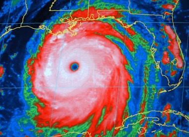
Hurricane outlook: Another busy Atlantic season
 Get ready for another busy hurricane season, maybe an unusually wild one, federal forecasters say.
Their prediction Thursday calls for 13 to 20 named Atlantic storms, seven to 11 that strengthen into hurricanes and three to six that become major hurricanes.
The National Oceanic and Atmospheric Administration said there is a 70 percent chance that this year will be more active than an average hurricane season.
If you live in hurricane prone areas along the Atlantic Ocean or Gulf of Mexico, “This is your warning,” said acting NOAA administrator Kathryn Sullivan.
The season starts June 1 and lasts through November. A normal year has 12 named storms, six hurricanes and three major storms with winds over 110 mph.
Last year was the third-busiest on record with 19 named storms. Ten became hurricanes and two were major storms, including Sandy, even though it lost hurricane status when it made landfall in New Jersey.
The only storm to make it ashore in the U.S. as a hurricane was Isaac, which ended up in Louisiana at 80 mph after hitting the Caribbean and threatening the Republican convention in Tampa, Fla.
This year, all the factors that go into hurricane forecasts are pointing to an active season, or an extremely active one, said lead forecaster Gerry Bell of the Climate Prediction Center.
Those factors include: warmer than average ocean waters that provide fuel for storms, a multi-decade pattern of increased hurricane activity, the lack of an El Nino warming of the central Pacific Ocean, and an active pattern of storm systems coming off west Africa.
The Atlantic hurricane season goes through cycles of high and low activity about every 25 to 40 years based on large scale climatic patterns in the atmosphere. A high activity period started around 1995, Sullivan said.
Ocean water is about 0.8 degrees Fahrenheit warmer than normal, but it’s not as high as it has been in other active years, Bell said.
The forecasts don’t include where storms might land, if any place. Despite the formation of more hurricanes recently, the last time a major hurricane made landfall in the United States was Wilma in 2005. That seven-year stretch is the longest on record.
Changes in weather patterns, especially the jet stream, have created fronts that in recent years tended to push many of the bigger storms away, Bell said.
But just because a storm is not technically classified major with 111 mph winds or more, doesn’t mean it can’t do lots of damage. Sandy is evidence of that; it killed 147 people and caused $50 billion in damage.
Forecasters this summer expect to see improvements in their calculations on how much a storm will strengthen or weaken, National Weather Service Director Louis Uccellini said. That’s because the National Hurricane Center will start using a new system that incorporates real-time radar from planes flying through storms into computer forecast models.
Meteorologists have had the most difficulty predicting changes in the intensity of storms.
Bell, who has been making these seasonal forecasts for 15 years, said his accuracy rate is about 70 percent. But last year, his predictions were far too low. He forecast nine to 15 named storms and four to eight hurricanes. There were 19 named storms and 10 hurricanes.
During the six-month season, forecasters name tropical storms when top winds reach 39 mph; hurricanes have maximum winds of at least 74 mph.
This year’s names: Andrea, Barry, Chantal, Dorian, Erin, Fernand, Gabrielle, Humberto, Ingrid, Jerry, Karen, Lorenzo, Melissa, Nestor, Olga, Pablo, Rebekah, Sebastien, Tanya, Van and Wendy.
You can return to the main Market News page, or press the Back button on your browser.

