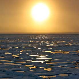
Arctic Melting Stacked Weather Deck in Favor of Superstorm Sandy
 A number of unusual atmospheric phenomena combined to form the massive “Frankenstorm” that was Superstorm Sandy. While many have said global warming fueled the storm’s strength, it is unclear exactly how it played a role. But scientists are starting to see evidence that warm weather in the Arctic led to conditions that made the hurricane so incredibly powerful.
An article in the March issue of Oceanography, authored by scientists from Cornell and Rutgers universities, points to 2012’s unprecedented Arctic sea ice melt as the root cause of the events that transformed a relatively modest storm into a destructive force.
A large kink in the jet stream, a high-pressure blocking pattern over Greenland and a mass of Arctic air pushing southward over North America’s middle latitudes each contributed to Sandy’s unusual strength.
An increasing body of research reveals that these weather events can be linked to loss of sea ice in the Arctic, said Charles Greene, professor of earth and atmospheric sciences at Cornell University, who contributed to the article.
Other natural phenomena like high tides also came into play, but “greenhouse warming and Arctic sea ice loss stacked the deck in favor of the conditions that allowed something like Sandy to occur the way it did,” Greene said.
Frigid air masses moved south
As Arctic sea ice shrank to record lows last year, newly exposed waters absorbed far more solar radiation than ice would have, allowing the ocean to store more heat. Greene explained that when fall and its cooler temperatures arrived in 2012, that heat was released into the atmosphere.
This lowered the temperature difference between the Arctic and the middle latitudes, calming the high-altitude cyclones that swirl above the northern latitudes. When these winds are strong, they hold cold air above the Arctic circle. But when temperatures in the Arctic are higher, the cyclones weaken, allowing masses of cold air to move south.
These cold air masses often cause nor’easters, winter storms that move up the Eastern Seaboard and dump massive amounts of snow on the East Coast, as with “Snowmageddon” in 2010. But in the case of Sandy, the cold air front added the characteristics of a nor’easter to the already potent hurricane, turning it into what Greene referred to as a “monster hybrid storm”
Additionally, the lowered temperature gradient caused the jet stream – a current of air that flows across North America at higher elevations – to bend into a large “S” shape.
“When the jet stream slows down, it starts to form much bigger waves,” explained Greene. “Kind of like a river – if a river is going fast, it pretty much goes straight, but when it slows down, then it starts to wind and meander.”
A sudden, late ‘hard turn’
Greene and his partners believe this kink in the jet stream helped form an unusual blocking pattern over Greenland, which in turn shunted Sandy to the west – just in time to slam into the East Coast.
“Most late-season hurricanes veer off to the east and don’t make landfall, and nobody pays much attention to them,” Greene said. “What Sandy did, which no late-season hurricane has ever done before, is it took a hard turn to the left. … The blocking pattern that was in the northwest Atlantic just basically shut the door.”
Superstorm Sandy can’t be directly, indubitably linked to the massive amount of Arctic sea ice that melted in 2012, said Greene. However, he thinks the idea is just as probable as the theory that Sandy was caused by a coincidental series of unusual, but entirely natural, events.
“Although a direct causal link has not been established between the atmospheric phenomena observed in late October 2012 and the record-breaking sea-ice loss observed during the preceding summer months, all of the observations are consistent with such an interpretation,” states the Oceanography article.
“We can’t say for certain that the blocking pattern was because of the record sea ice loss, but it’s consistent,” Greene said. “The probability of all those things happening out of a convergence of natural variability in the climate system – it strikes me as a lower probability than recognizing that we stacked the deck in favor of these conditions.”
You can return to the main Market News page, or press the Back button on your browser.

